
An Outline of the Early History of Arrington (48-1638)
- Nov 1, 2025
- 6 min read
Updated: Nov 4, 2025
Guest article by Arrington resident, historian and visual artist, Malcolm Barrett.
Arrington as Place
Arrington is a small rural village some 6 miles north of Royston in the County of Cambridgeshire lying
primarily on the A1198. It has a scatter of some 415 people. There is evidence of prehistoric activity in
Arrington but it is the evidence from 48 CE that most clearly forms a community here. Even if it is shared with other adjoining parishes. Arrington’s administrative area (formed by Parish Boundaries which still underpin our democratic process) were established later in the Late Saxon period in the 900’s CE. The boundaries for Arrington were defined by the River Rhee to the south; field boundaries to the west, a deep ditch to the north, but in the east partly by Ermine Street and a route through the Wimpole Park estate before returning to Ermine Street. Consequently Arrington straddles Ermine Street. The boundary through Wimpole Park and its estate is still recognised legally as the churches administrative area (which meant the WWII Hospital in the Park was in Arrington not Wimpole). The later civil boundary has now shrunk back towards Ermine Street.


The Name
The name Arrington is found to be made up of three Saxon words ton meaning farm, ing meaning the people of, and Earn meaning Eagle. These come together to form a description meaning farm of the people of Earn (ie Earnnington) or Eagle. However Earn appears to be a nature name rather than a personal name which may well mean that Farm of the people of Eagle should be read differently (eg as a people identifying with an eagle in some way). The first element ‘Earn’ also appears in Ermine Street (Earninga Straet) and found in 955 CE and some areas around Kington. Place name evidence supporting other evidence apparently places the inga term as arising in the 600’s. Approximately 150 years after the Roman withdrawal.
Armingford was also the name of a collection of villages as well as the ford itself but most of these villages are found south of Arrington. The first documented name evidence for the current Arrington village, was between 942 and 951 CE in the will of the saxon Bishop Theodred who owned the estate of Arrington.
Ermine Street
Ermine Street, between London and Lincoln is an early Roman military road, built around 48 CE, to aid the conquest of Britain. Later, other Roman roads joined it, (eg Akeman Street, to Ely - aka Cambridge Road, the A603), if not a further road that linked with Sandy. This promoted the growth of an un-named rest house and community at the junction of the River Rhee and the various roads. The community grew up surrounded by small fields and gardens and is both south of the river in Whaddon and Wendy as well as north of the River, in Wimpole and Arrington parishes. On the Arrington side it appears to be some sort of smithy or rural industrial workshop. However beyond the Arrington side of the settlement on the north bank, there was also a substantial wealthy villa or farm which the later parish boundaries were careful to go around but left it in Croydon Parish. Ermine Street, and Akeman Street are both Saxon names, for the Roman roads,
A child’s burial
In 1990, further north up the Ermine Way and in Arrington village, a body of a 9-11 month old Roman child was discovered in a Lead covered oak coffin, along with various grave goods that originated from central Gaul (France) and parts of Germany. The child’s body was buried with aromatic resin thought to be myrrh but now identified as Pistachio, an Egyptian embalming material to disguise the smell of decomposition. Still preserved, was some of her Blonde/brown hair and a coloured fine woollen/linen woven garment that she was wrapped in. The child was presumed to have died from Hydrocephalus (water on the brain). The figurines date from between 130-160 CE. The burial has been described as exotic for Cambridgeshire if not for Britain and was possibly the child of someone en-route along Ermine Street rather than a resident. Whether the child died in Arrington or the body simply brought here is unknown.
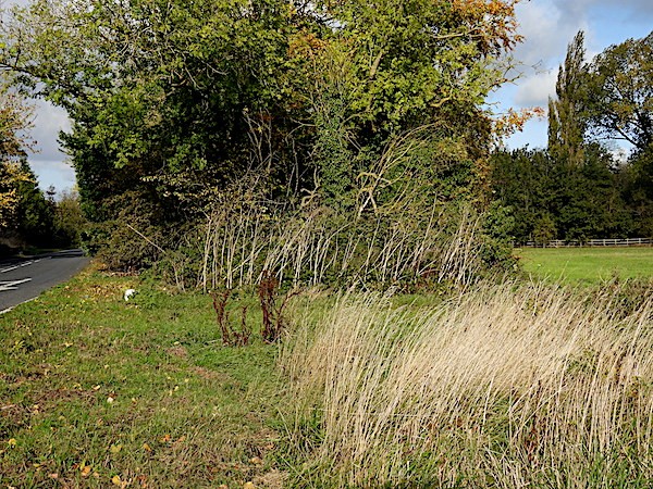
A ditch in the ‘Wasteland’
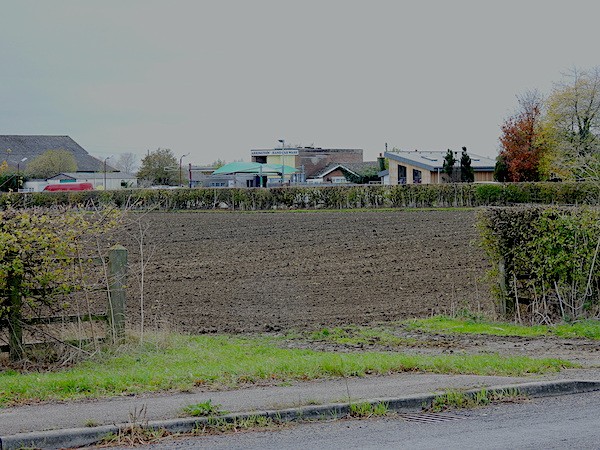
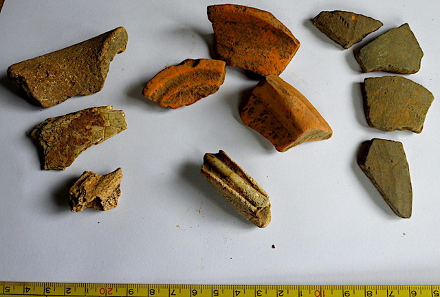
Again in 1990 but even further north and on the northern parish boundary ditch, on ground once known as common land, and which in the early C19th CE were still sheep walks (ie open land for sheep grazing and not ploughed), there were found buried, sherds of Roman pottery. One group was what is called ‘grey ware’ and the other ‘colour coated’. These would date at the earliest to around 150 CE and to be buried in the side of a ditch suggests that the ditch itself is also of Roman date. In fact this boundary could well be part of an extended Mare Way that has been identified as a Romanised pre-historic drove/track way with significant Roman period finds in the fields around Kingston Pastures Farm.


The oldest remaining building in the Parish
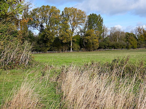
St Nicholas Arrington sits on high ground overlooking the Rhee valley and forms the most visible location of the village in the landscape. Even with present day tree cover it is noticeable from Wimpole Park.
We must however go back to the first known land owner who was Bishop Theodred who was both a Bishop of London and of East Anglia (909 - 953 CE) and it appears that he was given the estate of Arrington by King Edward the Elder (King of Anglo Saxons from 899 - 924 CE) Theodred in his will was then passing back his Cambridge estates to King Eadred (King from 946 -955 CE), who was King Edwards youngest son from around 942-951 CE. Theodred presumably anticipating his own end of life.
The Arrington estate was one of only two in Cambridgeshire owned by Theodred, the other being in Duxford and they appear to reflect King Edward the Elders strategy of fortifying Anglo Saxon communities as Boroughs such as in Cambridge, and Bedford to oppose and control Danish occupation as well as encouraging land to be purchased from Danish owners by Anglo-Saxons in Bedfordshire. Arrington’s strategic position and the ownership of Theodred would help protect London and the southern Anglo Saxon kingdoms from further Danish settlement. Ermine Street would have been a natural and relatively rapid route for Danish insurgence from the north and north west. Similarly Duxford commanded the River Cam as well as the Icknield Way thus protecting East Anglia as well as London. There is no evidence yet of how either Arrington and Duxford could effect any insurgence, although Ware has evidence of Ermine Street being blocked by posts (possibly for gates?) although thick hedges would also work, but both are only delaying tactics.
Anglo Saxon faith in East Anglia was Christian from the around the start of the 600’sCE., following St
Augustine mission to Kent although Hertfordshire to the South may well have been Christian from the Roman period onward. However Danish and Norwegian Faith was on the whole not Christian and Danish raids from around 865 CE were often to capture valuable Christian objects and slaves. Consequently the building of churches in Arrington and Duxford would be highly likely under an Anglo Saxon Bishop both for protection as well as for worship and burial. The church in Arrington also had a bell tower from the earliest period.

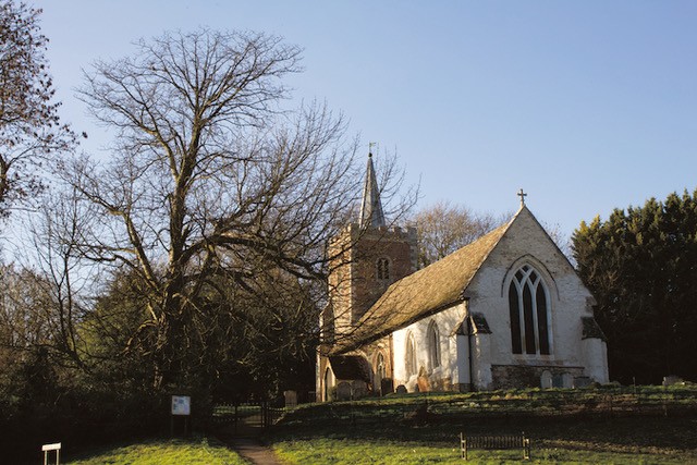

Although the current church only dates from around 1250 there is documentary evidence of a previous
church in Arrington in c1087. The church has a font that may well be the font from this earlier church. The church was then rebuilt in stages from around 1250 -1300CE and has an elaborate Piscina and two pieces of stone that suggest an elaborate alter. The Chancel was probably ceiled in wood and the roof was thatched. This was a time when the Nuns of Ickleford had a significant interest in the church.
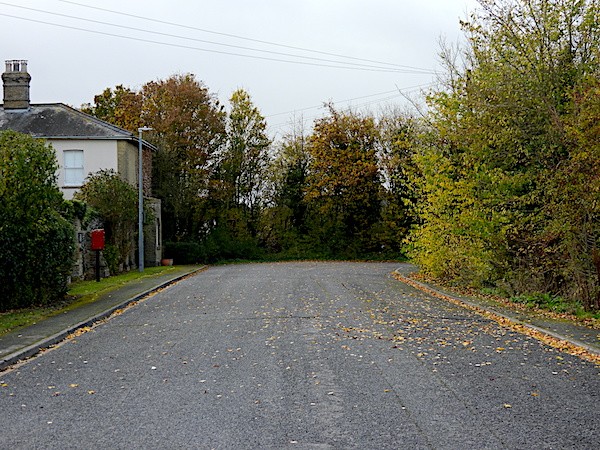
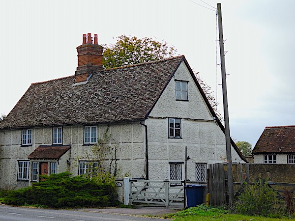
Beside the church are a number of old buildings/sites; ‘Church Farm’ (aka the ‘Bury’ where the old farm
buildings were burnt out in a fire in the early C20th and then replaced by new buildings); next to that is ‘King’s Close’ and ‘King’s Farm’ (now called the ‘Thatch’); the ‘Rectory’ (a C20th rebuild on the Old Rectory site) and a spring that old houses still have claim too for water. Beyond these another stream follows a small valley toward Ermine Street and Wragg’s Farm, and in the pasture are remains of other village habitations believed to be medieval if not earlier (the recent erection of two new houses at the end of Church End showed Saxon evidence).

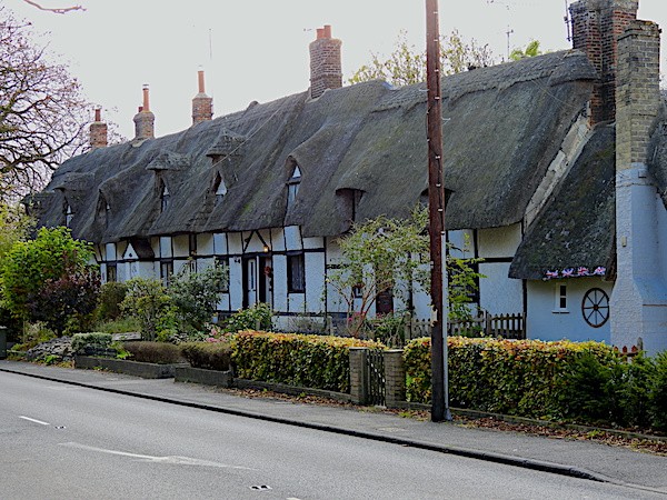

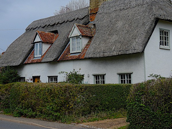


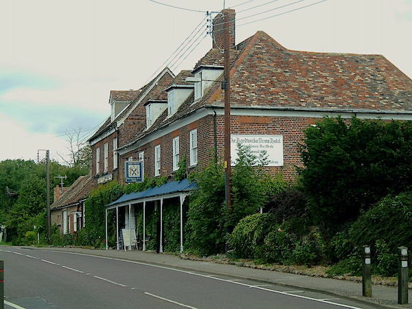
‘Crow End’ on Ermine Street probably represent houses that one stood on the East side of Ermine Way and were removed west to improve Wimpole’s Deer Park. The Hardwick Arms an important Coaching Inn on Ermine Way was evident in 1638 as was the thatched house to its south the only properties allowed to remain on/in Wimpole Park possibly because they related in some way to the Park.
Royston Museum is very grateful to Malcolm for contributing this guest article to our online exhibitions. All images are copyright of Malcolm Barrett.